Category:Panorama Trail
Jump to navigation
Jump to search
hiking trail in Yosemite National Park, California  ._View_north_from_Panorama_Cliff_trail._Little_Yosemite_Valley_is_above_Nevada_Falls_on_the_right._-_panoramio.jpg) | |||||
| Upload media | |||||
| Instance of | |||||
|---|---|---|---|---|---|
| Located in protected area | |||||
| Location | Mariposa County, California, Pacific States Region | ||||
| Operator | |||||
| Length |
| ||||
| Mountain range | |||||
| Terminus | |||||
 | |||||
Subcategories
This category has the following 5 subcategories, out of 5 total.
Media in category "Panorama Trail"
The following 11 files are in this category, out of 11 total.
-
 Descending the John Muir Trail between Nevada Fall and Vernal Fall.jpg 4,111 × 2,774; 4.32 MB
-
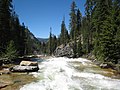
 Illilouette Creek and Panorama Trail.jpg 4,608 × 3,370; 5.81 MB
-
 John Muir Trail switchbacks between Nevada Fall and Vernal Fall.jpg 4,608 × 3,456; 5.61 MB
-
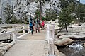 Nevada Fall Footbridge.jpg 4,608 × 3,035; 4.59 MB
-
 Panorama Trail Below Glacier Point.jpg 4,608 × 3,181; 4.94 MB
-
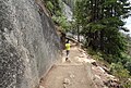
 Panorama Trail Climb.jpg 4,608 × 3,456; 5.65 MB
-
 Panorama Trail Near Illilouette Creek.jpg 4,608 × 3,456; 5.84 MB
-
 Panorama Trail Trailhead.jpg 4,608 × 3,456; 5.24 MB
-
 View downstream towards the bridge at Illilouette Falls - panoramio.jpg 1,440 × 1,080; 1.39 MB
-
 View upstream towards the bridge at Illilouette Falls - panoramio.jpg 900 × 1,200; 1.03 MB
-
 Yosemite-Panorama-Trail-P1060520.jpg 4,896 × 3,672; 7.14 MB


